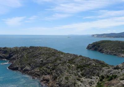
The first Trans-Pyrenees stage begins in Cap de Creus, the easternmost part of the great Pyrenees Mountains. The connection here between the land and the sea has resulted in an exceptional natural site, one of the jewels of the Pyrenees due to its beauty and uniqueness. From the tip of Cap de Creus we will head to the Cap de Creus Natural Reserve and walk on paths, trails and a stretch of road to the beautiful seaside town of Port de la Selva. This stage is ideal for getting familiar with the GR 11 signs, maps and/or GPS tools as well as the backpack and equipment we will carry.
Considerable. Derived from the length and ascent to overcome. This stage does not have any technical difficulties.
No special equipment required.
Cap de Creus. 1:25.000. Editorial Alpina.
Topographic base of Catalonia 1:25.000. Geological and Cartographic Institute of Catalonia (ICGC).
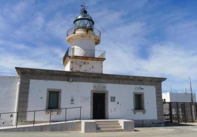
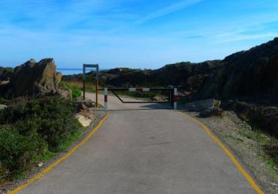
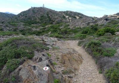
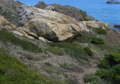
To reach the tip of Cap de Creus –Trans-Pyrenees crossing starting point or end– from the Cap de Creus lighthouse take the path that descends between the rocks towards the east. The white and red signs on the GR help you to identify the path and in about 10 minutes you will reach the point where there is a painted white and red circle that marks the furthest point of the GR 11. You are in the easternmost tip of the Iberian Peninsula. This is where the Pyrenees, the great mountain range, merge with the Mediterranean Sea.
Many hikers that approach the Trans-Pyrenees crossing from sea to sea go down to the water and soak their hands in the Mediterranean, a gesture they repeat when they finish their adventure at the Cantabrian waters. There are even people who pick up a little water with a container, water that will later be returned to the sea, the Bay of Biscay, symbolizing the end of the journey.
Let's start the exciting Trans-Pyrenees crossing at (1) the tip of Cap de Creus (0:00 - 20m). From that point retrace your steps between the rocks until you once again reach the (2) Cap de Creus lighthouse (0:12 - 80m). Go around the lighthouse to the right and go down a path and stairs that leads to a bend in the road. During the first part of this first stage, you will repeatedly cross the Cap de Creus road. Be careful to pay attention to the GR 11 red and white signs at all times and the Port de la Selva signposts, which will help you to always follow the route.
You reach a point where you have definitely left behind the road and you pass by Mas dels Rabassers de Baix and then (3) Mas dels Rabassers de Dalt (1:10 - 115m), which is now in ruins. Continue down a comfortable and enjoyable trail. Soon you will reach the Puig Melus area (151m) that we have on our right (N) and then you will find the (4) Tavellera cove detour (1:50 - 125m). Formerly the GR 11 route went down to the right until reaching this cove (NW). However, the current route continues straight along the trail to the left (W). A few meters ahead you will leave this trail, which turns to the left and you will continue along a path (W). The road goes up and down. You will cross the Nou Recs Stream, also called the Tavellera Cove Stream and we will pass along the ruins of Mas Vell. You reach a wider trail and just to the right you will see Mas Paltré. Cross the trail and go towards (5) Rec de Talabre (2:50 - 98m).
Go up the ridge of the hill and then back down towards (6) Sant Baldiri de Tavellera (3:05 - 135m), a chapel originating from the 10th century, although the current building that you see is from a later date. Continue along the trail towards W. After a series of junctions and turnoffs, always following the white and red GR markers, you will pass by the ruins of Mas Puignau, which you will leave to the right. You are at the highest point of this stage (190m). From here you will began to slowly descend towards the NW and Port de la Selva. Enter Port de la Selva in the area of the Figuerasses housing development and you will see the Tamariua submarine canyon to your right and its namesake cove below (N). Go around the Carbonera Hill (121m) to the right and turn all the way around towards Punta de la Creu. You will finally reach the port of (7) Port de la Selva (4:00 - 5m).
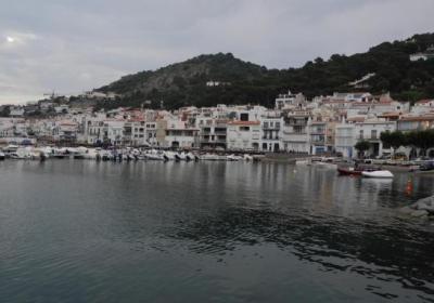
Port de la Selva is a beautiful seaside town full of charm, which has existed as a separate town since 1787, because originally it was only a Selva de Mar fishing port. Port de la Selva has a population of 1000 inhabitants spread out in various villages in the municipality, and its economy is based on tourism and fishing.
Start the Trans-Pyrenees crossing enjoying the Mediterranean waters at the tip of Cap de Creus.
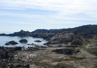
Get to know the magnificent rocky landscapes of the Cap de Creus Nature Reserve, as rugged as it is charming.
Walk around the town of Port de la Selva, a distinctly Mediterranean seaside town.
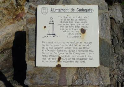
In 1971 Kirk Douglas and Yul Brynner filmed a movie in Cap de Creus? It was the The Light at the Edge of the World, an adaptation of the adventure novel The Lighthouse at the End of the World by Jules Verne. For the filming a fake lighthouse was built on the eastern tip of Cap de Creus, which was not definitively demolished until 2006.
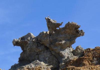
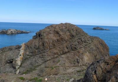
The incredible shapes of the schist (grey) and the pegmatites (white and orange) in Cap de Creus. These forms are the result of the differential erosion of these rocks under the action of the north wind and saline water from the sea for millions of years.
The route for this stage is very exposed to the sun and shade is scarce. If the weather is good, you can deviate from the GR 11 to visit the Paratge de Tudela, an area of great geological, vegetable and marine wildlife interest.

