In this twenty-first stage of the Trans-Pyrenees Crossing you will reach the Aigüestortes i Estany de Sant Maurici National Park, an exceptional and unique reserve that holds the rank of National Park in Catalonia. You will enter the park on its eastern side, going up the beautiful river valley of Escrita, from Espot until reaching Sant Maurici Lake. During the stage you will alternate different types of terrain and visit the beautiful typically Pallars villages of Jou and Estaís. You will sleep at the Ernest Mallafré Refuge, which is located close to Sant Maurici Lake and at the feet of Els Encantats, which allows us to leisurely enjoy one of the most admired landscapes in the Pyrenees!
Considerable. Derived from the length and ascent to overcome. This stage does not have any technical difficulties.
During the winter you can find snow at high altitudes.
No special equipment required.
Aigüestortes i Estany de Sant Maurici National Park. 1:25.000. Editorial Alpina.
Topographic base of Catalonia 1:25.000. Geological and Cartographic Institute of Catalonia (ICGC).
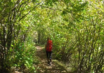
Let's begin the 21st stage of the Trans-Pyrenees Crossing to (1) Guingueta d'Àneu (0:00 - 941m). Leave Guingueta by the border of the river and immediately the GR 11 leads you to a trail that zigzags up through the area of les Marrades. You will ascend quickly and advance on the northern side of the Jou Ravine until reaching the small town of (2) Jou (0:50 - 1,300m).
In Jou take the road that leads you to the town of Estaís towards the south. Hike 2.5 km on this road until, shortly before reaching the antenna of Cap Seré, you will take the path that goes off to the right and ascends a few meters up the mountainside. This path is the old Jou road to Estaís and it advances parallel to the road but a few meters above You will flank the mountain and it won’t take long before reaching (3) Estaís (2:00 - 1,404m).
From the village of Estaís you will have to descend to the river valley of Escrita and cross it. Leave Estaís by means of its extreme south and hike 300m on a dirt track. Then leave the track behind (which turns to the left and winds down the mountainside) and take the path that directly (SW) goes down towards the bottom of the valley and crosses the Estaís Road (narrow), the Espot Road (wide) and the Escrita River. After winding down the road it goes straight towards the west. You will begin to go up the river valley of Escrita by means of the shady side of the valley. You will discover a dirt track and pass by the side of the ruins of the chapel of Santa Maria d'Espot and continue until reaching(4) Espot (3:00 - 1,312m).
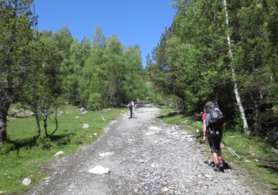
Cross Espot and continue going up the valley by means of the access road to Aigüestortes i Estany de Sant Maurici National Park. Walk approximately 1.7 km along the road to until reaching the altitude of (5) Suar Bridge (3:35 - 1,438m). At this point leave the road and pass along the sunny side of the valley (N), crossing this bridge. The road is very beautiful and you can admire the classic "U" shape of glacial valleys. Advance with the river on your left, crossing some meadows and wooded areas. Some 2.1 km after having left the road, on the other side of the valley (S) you can get a glimpse of the car park and information point of Prat de Pierró. From this point, the traffic passing through the road is restricted.
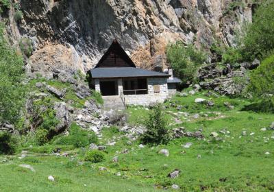
Continue up the valley. Close to the Pallers Bridge you will cross a paved path and thereafter you will join it for a stretch. Pass by the side of Sant Maurici Chapel and you will zigzag as you go up. When you reach the access road to the Ernest Mallafré Refuge, leave the GR 11, which continues until reaching nearby Sant Maurici Lake, and go up a few meters until reaching the (6) Ernest Mallafré Refuge (5:30 - 1,893m).
The picture of Sant Maurici Lake with the silhouette of Encantats just behind.
Walking the so-called Ruta de l'Isard, between Prat de Pierró and Sant Maurici.
Discovering the small villages of Jou and Estaís, and the village of Espot.
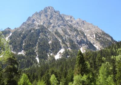
The legend says that Els Encantats were two hunters who were petrified as divine punishment? According to legend, two hunters in the area went to Sant Maurici Chapel and began to make fun of the saint. Then a large deer appeared and the hunters began to chase it, but the animal suddenly disappeared. When the two hunters arrived at the place where it had disappeared, lightning struck, which turned them into two large blocks of stone, Els Encantats.
La Ruta de l'Isard, the name given to the route that goes from Prat de Pierró to Sant Maurici Lake. This section of the trail runs through the interior of lush forests and subalpine meadows. At the "Pont de Pallers" cabin you can visit an exhibition on traditional forest exploitation in these Pyrenean valleys.
In Espot you will start the Trans-Pyrenees Crossing GR 11-20 variant: this long variant goes to Pont de Suert going through the Aigüestortes i Estany de Sant Maurici National Park by means of its south side (Peguera Valley, Negre de Peguera Lake, Saburó Mountain Pass, Colomina Refuge, Font Sobirana Mountain Pass, Taüll, Boí).


